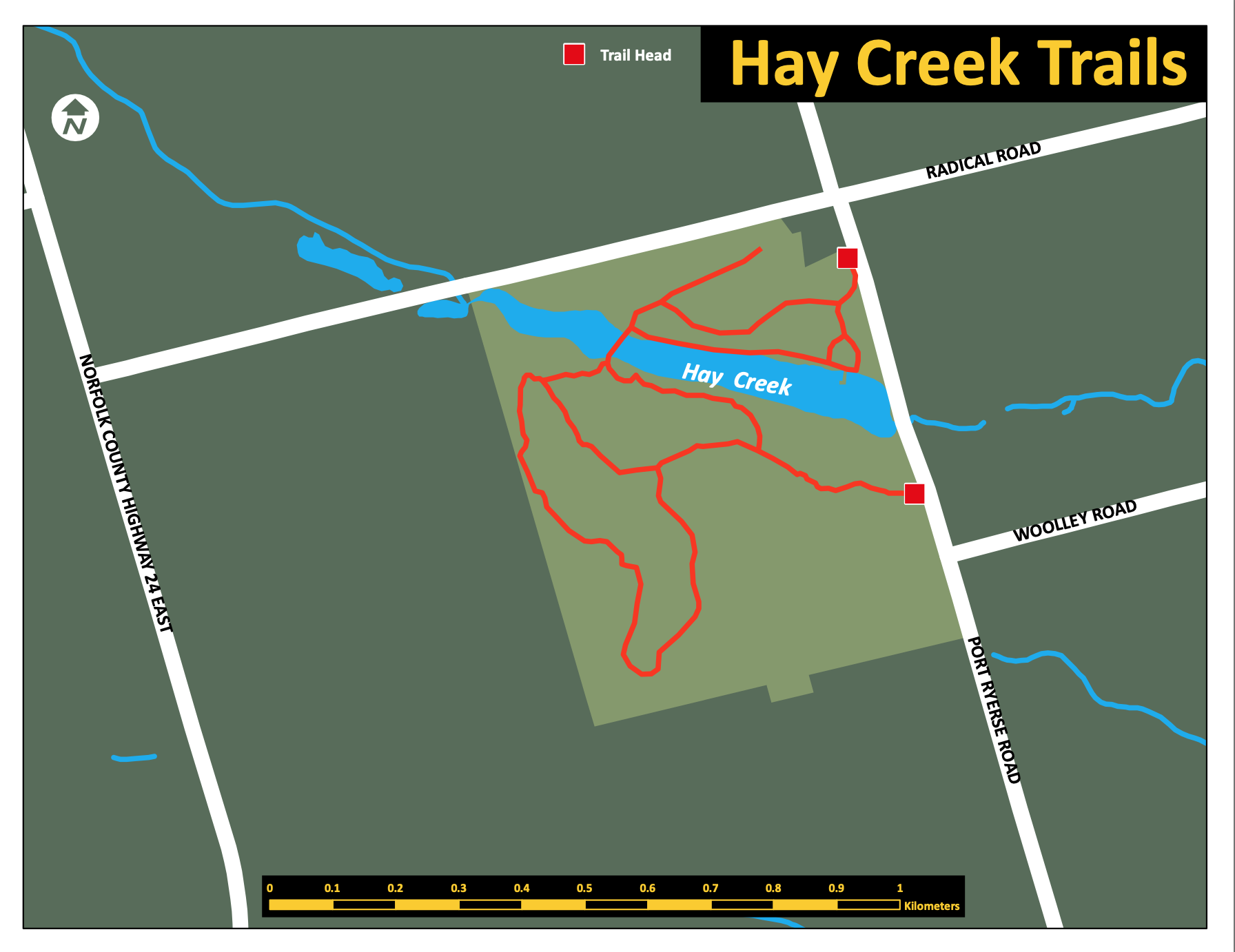
Hay Creek Trail Map
Hay Creek Trail Map
Welcome to Hay Creek Conservation Area!
Located just 5km west of Port Dover, enjoy walking along the 2 km nature trail that loops through wooded areas and past the Hay Creek Reservoir which provide opportunities for bird watching as well as viewing a variety of plants. Hay Creek is also home to some Carolinian forest species. No camping or swimming allowed.
Accessibility Information
- Note that the hills and natural base with exposed tree roots may make it difficult for some users.
Trailhead and Access Points
Nature trail can be accessed at:
- The entrance to the conservation area, on Port Ryerse Road.
- Alternative trail entrance a little farther south, on Port Ryerse Road, passed the dam.
Parking
Parking is available at the two entrances on Port Ryerse Road.
Organization: Long Point Region Conservation Authority
https://www.norfolkcounty.ca/visiting/norfolk-maps/downloadable-pdf-maps/#trail